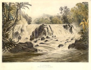
The Royal Geographical Society of London entrusted Sir Robert Hermann Schomburgk with conducting an expedition of exploration of British Guiana in 1835; his work, it is claimed, led to the successful Venezuela and Brazil boundary arbitrations for Guyana, then British Guiana.
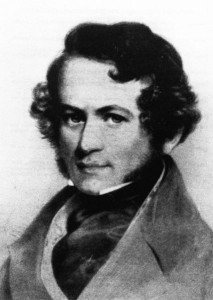
Schomburgk was born June 5, 1804 in the town of Freyburg on the River Unstrut, in Germany. The eldest of five siblings, he showed an early interest in nature, and in the 1820s, while living with his uncle, he learned botany from a professor.
Later, after several years of drifting through several Caribbean islands following his unsuccessful stint as a US businessman, he voluntarily funded and took on the task of mapping the unexplored areas of the British Virgin Islands coast of Anegada. Schomburgk’s work so caught the attention of the Royal Geographical Society (London) that the society proposed he should go to South America under its commission.
Arriving in British Guiana in 1835, he made three trips for the RGS, the first to the Rupununi, including the Kanukus in search of the plant used to make curare; the second, up the Corentyne and Berbice River, was made in 1837 where he discovered the Victoria regia water lily. On his last trip for the RGS, Schomburgk travelled to the source of the Essequibo River, the upper Orinoco, the Rio Branco basin and Mount Roraima where he came across slavers who regularly raided indigenous villages; it was here that he realized the need to define boundaries to help prevent such raids.
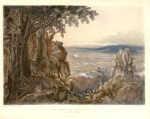
The demand for border definitions for the protection of the indigenous tribes stepped up pressure on the British government to establish the borders in the south-west and the west.
The British government then commissioned Schomburgk in April 1841 to survey and mark the boundaries of British Guiana.
Along with his brother Richard, Schomburgk set off west, along the Barima, Barama, Waini, Amakura and Cuyuni Rivers. The second expedition took him to the Brazilian frontier, including Pirara. After Pirara, the team mapped the Takutu and Ireng Rivers then returned to the Kanuku Mountains.
The region around Roraima followed, and Schomburgk’s last journey was to the upper Corentyne and the Kutari River.
By this time, both the Brazilians and the Venezuelans had complained officially to the British government about Schomburgk’s placement of boundary markers, which subsequently had to be removed.
The “Schomburgk line”, as it was called, came to form the basis of the British claim at the arbitral tribunal in Paris in 1899 that settled the boundary with Venezuela.
Guyana was awarded a large portion, but not the whole of that claim. The Brazil boundary was settled after arbitration by the King of Italy in 1904 where the Schomburgk line also played a role.
Schomburgk was to play a posthumous role in fixing the tri-junction point of the Suriname, Brazil and Guyana boundaries in 1936.
Throughout his travels, the explorer also collected numerous plant and animal specimens and accumulated many maps. Bird specimens were given to museums; fishes, animals and animal skulls preserved by the explorer were also donated, as were many dried plants, fruits, seeds and living orchids.
Schomburgk was knighted in 1844 and sent to Barbados as a diplomat in 1846. In 1857, he was sent to Santo Domingo as British Consul then to Bangkok, Thailand. He returned to London in ill health and retired in 1864, dying March 11, 1865 in Germany. (Taken from Guyana Times Sunday Magazine)


Comments are closed.